Have a piece of land and want to measure its distance, area or circumference? GPS Fields Area Measur..
2.3.0| License: Free |
| Released: Farmis |
| Request: iOS 9.3 |
| Last updated: 20-09-2021 |
| OS: iOS |
| Version: 2.3.0 |
| Total download: 1100 |
| Capacity: 71 MB |
MENU
Have a piece of land and want to measure its distance, area or circumference? GPS Fields Area Measure for iOS will help you to do that using your iOS device.
App measures area and perimeter land using iOS device with GPS system - GPS Fields Area Measure
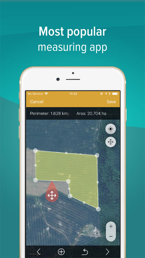
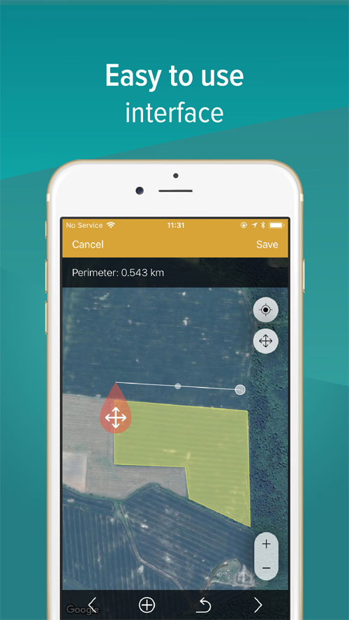
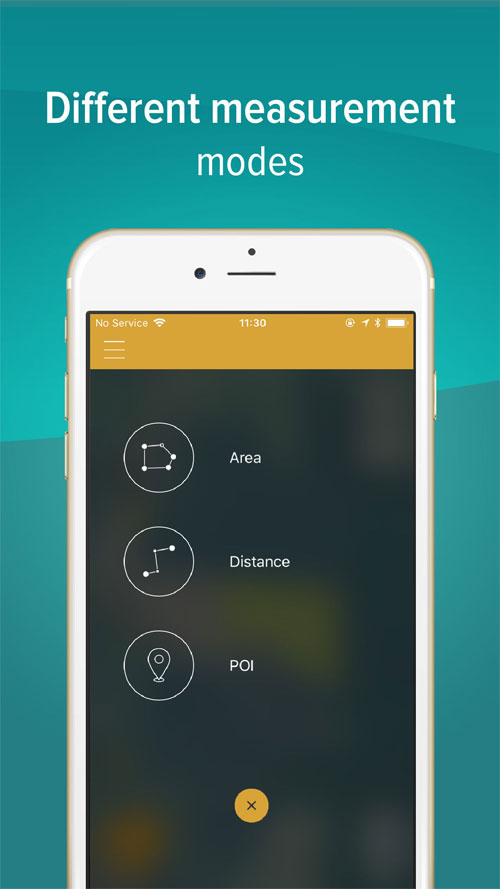
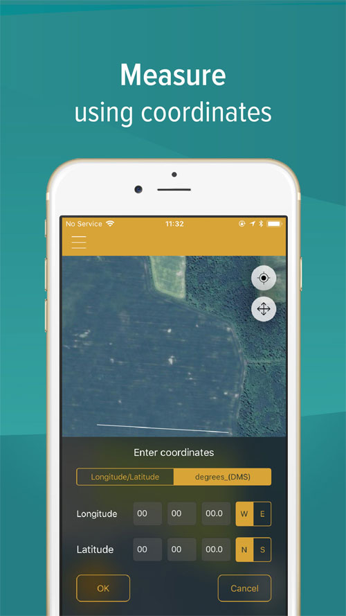
GPS Fields Area Measure iOS is an excellent, free measurement app that helps you Measure the area of an area in square meters, acres, or square kilometers with two options: manual measurement (with markers on the iOS device screen) and GPS measurement (motion tracking device) when you follow the perimeter of a certain area).
GPS Fields Area Measure for iOS is a useful tool when you travel and want to measure the distance between two points or city, or in agriculture when you need to know the area of a field to calculate the application rate of a sprayer or determine the stocking rate and use in quite a few other cases.
Share updates and specs measure with friends or colleagues
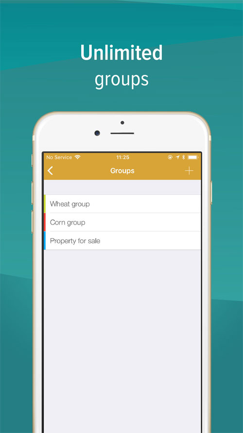
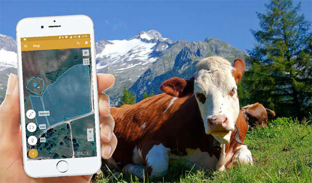
GPS Fields Area Measure application is also a useful map-based measurement application for outdoor activities, finding the range of sports activities. such as cycling or hiking, exploring the golf course or acting as a hole-gauge, land surveying, gardening, farming, livestock, as well as storage store soil measurement information.
In addition, this is also a useful tool for construction, fencing in agriculture, installing solar panel, estimating area building a roof or planning a trip.
GPS Fields Area Measure widely used in many different fields
GPS Fields Area Measure for iPhone is the most accurate measurement application on the market, designed Application in many fields such as construction or agriculture, and is the number one choice of those who are planning to roof, build houses or roads, farm owners who are fertilizing, sowing seeds or harvesting. .
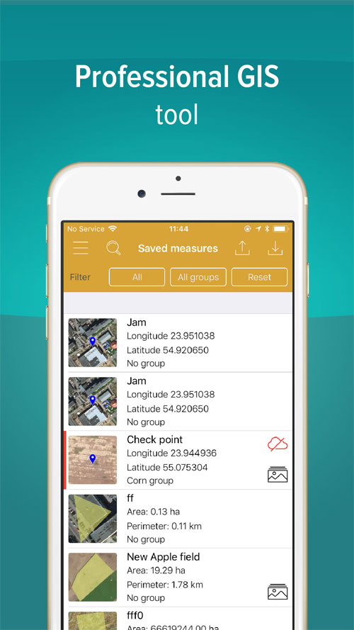
In addition, for livestock and poultry farmers, the application is also useful in measuring and building fences and barns. Pilots will also be able to use GPS Fields Area Measure while in flight. Farmers and builders will also be able to use the app to calculate the acreage or plot of land. The entire area is displayed on Google Maps.
GPS Fields Area Measure 2.3.0
In response to user request, developer removed photo cropping. In version 2.3.0, Rento UAB will introduce full-size image attachments. The developer also added a zoom option to the app. Feel free to try new functions and easily share datasets with your friends.
Attach up to five photos per measurement. Open MAP, select Marker / Field / Distance. Once selected, the yellow floating action button will turn red and the "Add Photo" icon will appear. You'll now be able to add a photo of yourself from your photo gallery or take a new photo.
New feature:
Bug Fix:
.
Zenly for iOS, Zenly for iOS is an interesting and fun locating ..
Earth mapping application Google Earth for iOS will provide for u..
To celebrate Google Maps turning 15, the “giant” Google has been ..
Binh Anh for iPhone is a journey tracking application that suppor..
GPS Phone Tracker for iOS is a GPS tracking service, using worldw..
5
4
3
2
1