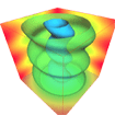
3DField is a software that converts data into maps and surface land. The software helps to create 3D..
4.2.5| License: Free |
| Released: Vladimir Galouchko |
| Request: Windows XP/Vista/7/8 |
| Last updated: 19-08-2021 |
| OS: Window |
| Version: 4.2.5 |
| Total download: 1677 |
| Capacity: 5,7 MB |
3DField is a software that converts data into maps and surface land. The software helps to create 3D maps from scattered points, digital data or other data sets.
Making is now easier and simpler with the help of computers. Software such as 3DField easilydesign 3D maps, send it to the Global Positioning System GPS or simply print it out. With 3DField, all aspects of 2D and 3D maps can be customized exactly to what you want.
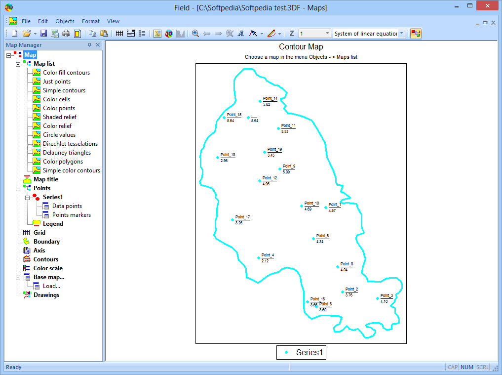
By being able to draw contours of any shape, you'll be able to forget about other complicated and modern navigation systems when using 3DField. The software also allows to create points of interest, add values, names to that place, and remember to choose the location carefully by choosing to display the grid map. The draw function not only helps create contours, but can also be used whenever you need to emphasize something on the map.
The 3DField interface offers a spacious workspace and almost all the space to display the map. Users can hide the Map Manager tag for an even larger workspace. All elements on the map are listed in the Map Manager, tag from where you will be able to edit or delete. Among the information must be mentioned the scale of the map and the elevation of the land marked on the map. Although the interface is relatively simple, the software still requires users to have time to gradually discover the functions, especially for inexperienced people.
Provides a full range of map creation functions, 3DField shows the ability to be very useful to users, especially those who work in the field of cartography and geodesy. Although it takes a bit of time to learn, it seems that it will not be too difficult when you are familiar with the functions of 3DField. If you want to draw 4D maps, choose 3DFieldPro.
The Weather 14 days is a handy, accurate and free 14-day weather ..
Zimbra Desktop is an open source software that allows users to br..
LINE is a free, multi-featured messaging and calling app with an ..
Skype is a free messaging, calling, video calling app with good q..
Mailbird 2.5.43.0 is a utility designed to help users manage thei..
5
4
3
2
1