
Quantum GIS is an existing mapping and map editing software that provides an extremely powerful and ..
2.12| License: Free |
| Released: Gary Sherman |
| Request: Windows XP/Vista/7/8 |
| Last updated: 19-08-2021 |
| OS: Window |
| Version: 2.12 |
| Total download: 2513 |
| Capacity: 279,3 MB |
Quantum GIS is an existing mapping and map editing software that provides an extremely powerful and useful set of advanced tools for users.
For users who are professional cartographers, mapping software Quantum GIS provides users with a complete and very useful set of advanced tools. based on Geographic Information System (GIS). Even if you're not a cartographer, you'll be able to experience the sensation of reimagining the world around you with Quantum GIS.
<3 measurement data and address form. This database system will help users draw geographical maps quickly.
Quantum GIS will also be able to simply act as a map viewer as it can browse existing maps. Supporting vector, raster and many other data formats besides GPS data, Quantum GIS is a very useful tool for cartographers.
The user interface of Quantum GIS is not really easy to use if you are using it for the first time. It requires a bit of map knowledge, but don't worry because Quantum GIS has detailed documentation to help you quickly learn how to use it.
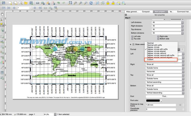
Quantum GIS brings many tools in the main interface
1 Once you're familiar with Quantum GIS, you'll be able to start using the toolkit and master formats like PostGIS or SpatiaLite as well as Vector and raster formats are supported because OGR and GDAL (Geospatial Data Abstraction Library ) including files in the format ESRi, GML (Geography Markup Language), MapInfo or SDTS.
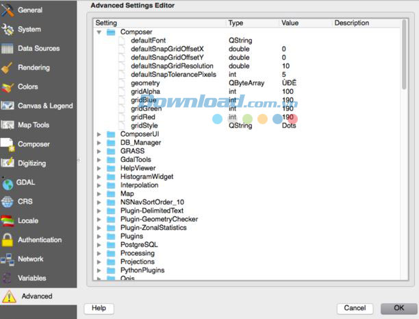
Other settings in Quantum GIS
The main purpose of Quantum GIS revolves around viewing and creating products in vector, raster, spatial map data, interactive terrain exploration, and the ability to edit, create, and analyze map...
Editing an existing map starts easily with image markers, labeling, overlay vectors, grid layers, defining functions or editing properties. With the help of these tools, you will also be able to manage vector features. The field and raster calculation tool comes with the plugin and the GPS tools will assist users in creating, editing or exporting their own image data.
System Requirements
Overall, Quantum GIS can be considered the best tool as it offers a full set of functions and is very powerful if you need to know more about GIS or already have the knowledge and ready to create maps for myself. Functions and features make it stand out from other software of its kind and that's why the user community loves this software so much.
The Weather 14 days is a handy, accurate and free 14-day weather ..
Zimbra Desktop is an open source software that allows users to br..
LINE is a free, multi-featured messaging and calling app with an ..
Skype is a free messaging, calling, video calling app with good q..
Mailbird 2.5.43.0 is a utility designed to help users manage thei..
5
4
3
2
1